CITIES Research
The Center for Interacting Urban Networks (CITIES) at New York University Abu Dhabi (NYUAD) is an interdisciplinary research center dedicated to advance urban science and promote cutting-edge research that is translated into practical, real-world solutions for the benefit of society. Our ultimate goal is to foster sustainable, resilient, and equitable cities with a particular emphasis on Abu Dhabi and the UAE.
This newsletter focuses on our Urban Mobility efforts and offers an overview of CITIES’ ongoing research projects and educational and outreach initiatives.
Daily Mobility Adaptations and their Consequences During the COVID-19 Pandemic
Kinga Makovi, Assistant Professor of Social Research and Public Policy, CITIES Co-Principal Investigator
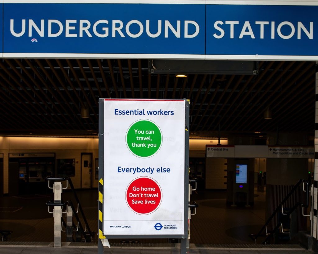
In 2020, the COVID-19 pandemic pushed governments to emanate stay at home orders, impose restrictions on public transportation, and close schools. Many people also transitioned to remote work. These changes upended our daily lives and had direct implications for how people move in cities. Our recent work has focused on measuring and understanding the consequences of these mobility changes using cellphone data in the 25 largest cities in the United States during 2019-2021. We compare post-pandemic to pre-pandemic patterns and link these alterations to the emergence of racial and ethnic inequalities in case rates.
To understand changes induced by the pandemic, we think of urban mobility networks in at least three ways. First, urban mobility networks are characterized by the existence of hubs such as downtown areas or central business districts, through which a high proportion of travel flows. Second, we can measure neighborhood isolation or the degree to which some neighborhoods are densely connected to one another while they remain disconnected from other parts of the city. Finally, we can also take into account the racial and ethnic composition of places people visit to understand whether neighborhood isolation means group isolation as well.
We find that the importance of hubs decreases dramatically during the first peak of COVID-19 cases in the U.S., around the time of the declaration of national emergency. But hubs in the mobility network quickly reemerge by the summer of 2020. We also see mobility networks become more modular and remain so throughout 2020 and 2021, even as vaccinations become widely available. Furthermore, using a new measure of racial and ethnic segregation in mobility networks, we show that more mobility isolation also means that people are limiting their travel to places that have similar demographic compositions to their home neighborhood. In a subsequent study of pandemic spread in Chicago, we use epidemic simulations to show that this racial and ethnic segregation of mobility partially explains the emergence of case rate inequalities.
Together, our recent work highlights the ways that mobility in cities became more unequal during the pandemic, and these inequalities of movement lead to further inequalities in health. These findings are important to help guide decision makers as they develop new and more equitable public health policies.

Is the Propagation of Traffic Congestion Predictable?
Monica Menendez, Associate Dean of Engineering for Graduate Affairs, Professor of Civil and Urban Engineering, CITIES Director and Lead Principal Investigator
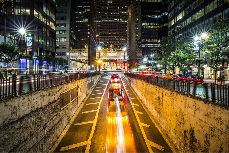
Traffic congestion is a concern for cities worldwide. A growing urban population combined with higher motorization rates are leading to increasing levels of congestion and all the negative externalities associated with it. Is it possible to predict how such congestion propagates in a city? Is there a point at which congestion becomes so widespread that the road system cannot easily recover? Can we deploy proactive mitigation strategies to reduce the spread of congestion? Research using real data from multiple cities around the world is giving us the first insights into these questions.
We now know that temporal patterns of vehicular traffic define the performance of urban road networks. As a result, traffic and the ensuing congestion patterns for any given city are reproducible across days. This is further evidence of the regularity of human mobility, and has clear practical implications for traffic monitoring and control.
In fact, it is possible to relate the road level dynamics to the network level dynamics by observing the number and size of traffic congestion pockets. This allows us to use concepts from physics (such as percolation) to describe the propagation of congestion, so that we can model it using sparse network-level data. Moreover, it gives us insights into the ability of different networks to cope with congestion, and the moment at which such congestion becomes so widespread that the whole network collapses.
It is enough to monitor the traffic performance of only a few roads to classify daily patterns and the resulting congestion patterns. This allows cities to reduce monitoring costs. Moreover, it provides opportunities for enhanced traffic control in a proactive fashion. As soon as a given traffic pattern is detected early in the day, traffic control mechanisms tailored specifically to mitigate the congestion associated with that pattern could be deployed, avoiding then the collapse of the traffic network.
Overall, our newest research brings together concepts from statistical physics and transportation engineering into a single science of traffic networks, with the goal of improving the performance of urban traffic, ultimately making our cities more sustainable.
More is Different
Saif Eddin Jabari, Associate Professor of Civil and Urban Engineering, CITIES Co-Principal Investigator
Systems with very large numbers of interacting agents are very difficult to analyze with the traditional tools of science. This is especially the case when the constituents of the system, e.g., humans, behave in ways that are hard to predict. But there is a striking feature that such systems all seem to possess: universality. Universality suggests that complex systems of different types, i.e., composed of different agents (e.g., particles, humans, or artificial bots), in aggregate, exhibit the same features. This leads to the notion of universality classes, where remarkably different systems collectively behave the same way. On the one hand, this leads to a taxonomy, but more profoundly, it says that the idiosyncrasies of the agents are irrelevant when put together. Indeed, consider an intricate object, e.g., a model of a city built with LEGOs. The shapes of the individual pieces are immaterial to the overall design: The shape of the resulting model can be far more sophisticated than the shapes of the individual parts. More is different!
Traffic on city roads is a complex system. Its constituents are choices made by commuters. The theory of traffic flow, which informs decisions made by traffic engineers on city streets daily, is mainly based on heuristic rules developed over half a century ago. But this is changing. With the increased deployment of sensing technologies in cities, the data reveal emergent collective phenomena that hint at a sort of universality. Research conducted by the Traffic Dynamics and Computations Group at NYUAD, funded by CITIES, is investigating emergent phenomena in traffic dynamics. The team has developed theoretical frameworks that reveal universal behavior in traffic. The following thought experiment offers a good illustration of the findings.
Consider a system consisting of vehicles traversing a very large single-lane circuit or race track. Suppose the vehicles are positioned far apart initially so that no vehicle restricts any other’s motion. Each vehicle-driver unit is endowed with their own desired speed and preferred distance from their leader (when and if restricted by a vehicle ahead). One can easily see that, eventually, the slowest vehicle in the system will dictate the speed of all the vehicles as they traverse the circuit. They will gradually slow down behind the slowest vehicle and ultimately form a single platoon. The distances between the vehicles in the large platoon will vary in accord with the preferences of the individual vehicle-driver units. A surprising finding is that the distribution of distances is independent of the distances that the drivers prefer and instead is that of the platoon leader. It is as though the drivers relinquish their own free will. More accurately, the system’s behavior as a whole does not care about the choices of the individual drivers. The emergent dynamics are different.
Ultimately, traffic systems are constrained social systems. It is reasonable to conjecture that findings in traffic transfer to other social systems. These findings could lead to paradigm shifts in how we manage traffic and congestion in cities and our understanding of human interactions more broadly.
CITIES Multidisciplinary New Projects
CITIES’ mission is to establish a vibrant and globally recognized knowledge hub for urban networks, bridge the gap between scientific significance and practical value, and further develop the human capital that will propel the city of Abu Dhabi and the UAE into a more prosperous and sustainable future.
Fully aligned with its mission, CITIES recently funded and activated four new interdisciplinary projects. The first two integrate the expertise of Principal Investigators from different NYUAD divisions. The second two are co-funded in partnership with the Center for Cyber Security (CCS) and are at the crossroads of both centers.
CityGraph: A Participatory Open Data Framework with Applications to Geolocalized Longitudinal Data in Smart Cities
Led by Djellel Difallah, Assistant Professor of Computer Science & Etienne Wasmer, Professor of Economics
This project aims to foster civic engagement in urban data gathering and analysis thanks to, among other things, the creation of a new platform for data sharing. Smart cities require data collection and exploitation (e.g., data mining, real-time anomaly detection) to increase their efficiencies. The generic issue in science, as well as for policymakers, is that the data producers, such as residents, may not be the end-users of the data. This leads to inefficiencies, gaps, and inconsistencies. This project proposes a general methodology to reconcile the objectives of data contributors and data users. In particular, it will apply this methodology to the problem of collecting geolocalized longitudinal data. The team will study two situations relevant to smart cities: first, high frequency (within a day) of intra-city mobility, and second, low frequency (months, years) of inter-city mobility to understand the general case of attractiveness and efficiency of a city over time. For that, the team will investigate how a smart city can foster the participation of its residents and tap into open data and public knowledge bases to measure critical aspects of its development. In the long term, the CityGraph project aims to create a platform for data sharing and contribution. This will provide a framework to collect new forms of data crucial to studying various societal questions.
Towards Sustainable Coastal Development in the Emirates
Led by John Burt, Associate Professor of Biology & Rana Khalid AlMutawa, Assistant Professor/Emerging Scholar of Social Research and Public Policy
This project aims to support scientifically informed, more sustainable coastal development in the UAE. To do that, it draws on expertise from the social sciences, natural sciences, and engineering. The rapid rate of urbanization has reshaped in only a few decades the coastal zone of the whole UAE with profound, still not well documented and understood, repercussions on its inhabitants and the biosphere at large. Using a combination of systematic literature reviews and remote sensing, the project will document changes to coastal zones in the Emirates since the 1990s. Furthermore, it will explore the social implications of recent coastal urbanization through interviews with key societal stakeholders such as fishers, divers, tour operators, coastal developers, industrialists, marine planners, and environmental regulators to understand their perceptions of the social consequences of coastal change in the Emirates. Finally, it will promote more socially and environmentally sustainable coastal development practices for the UAE by developing a combination of policy recommendations and ‘proof of principle’ demonstrations using eco-engineered seawall designs.
Securing Construction Networks for the Cities of the Future
Led by Borja García de Soto, Assistant Professor of Civil and Urban Engineering & Sanjeev Goyal, Professor of Economic
This project aims to better understand and mitigate cybersecurity vulnerabilities across the lifecycle of construction projects due to the increasingly digitalized and connected built environments. The construction industry plays a significant role in the UAE’s Gross Domestic Product (GDP). The ongoing digitalization and automation transformation that this industry is going through, referred to as Construction 4.0, affects how we design, build, and operate our built environment beyond critical infrastructures. Although Construction 4.0 has many advantages, it also opens the door to several challenges and vulnerabilities. Recent reports list the construction industry at the top of cyberattacks, which is concerning given a large number of stakeholders (public and private) across the different phases of construction projects, and the complexity and dynamic nature of their interactions. This study will look at the cybersecurity challenges and vulnerabilities, focusing on the interaction among the many network organizations and participants. The results of this work will provide recommendations and offer support to policies to minimize the spread of vulnerabilities.
Privacy-preserving Intra-City Collaborative Learning for Health Screening Applications
Led by Farah Shamout, Assistant Professor of Computer Engineering & Michail Maniatakos, Program Head of Computer Engineering, Associate Professor of Computer Engineering
This project aims to develop a privacy-preserving collaborative learning framework that can be applied in UAE nationwide programs that rely on data exchange, such as health screening. The work involves the development of (i) a collaborative learning framework that enables optimal training of deep neural networks, the backbone of the AI decision-support tools, across multiple parties, and (ii) a data encryption technique to facilitate secure data exchange. The team will focus on a real-world setting using data collected from multiple hospital facilities in Abu Dhabi. This study will create the basis for a novel secure data transfer and collaborative learning framework that can facilitate the exchange of a wide variety of sensitive data within smart cities.
CITIES is Proud to Present NYUADAir
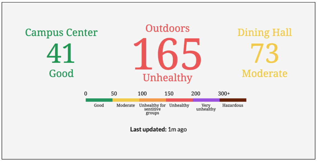
NYUADAir is a network of air quality sensors that monitors the concentration of particulate matter PM2.5 around campus. Real-time data are shown on our screens on campus in the C2 and D2 buildings and are now available on the NYUAD intranet.
The sensors are installed to raise awareness among the NYU Abu Dhabi community toward more sustainable and healthy-living lifestyles. The isolated location of our campus can give us a misleading perception of comfort and cleanliness: we are not constantly surrounded by polluting vehicles or smoke-churning factories. The contemporary issue of air pollution thus gets selectively compartmentalized. It is hard to pay attention to the air we breathe in our daily lives: it is not a priority. Little do many of us know that air pollution from traffic, industries, oil refineries, and sandstorms in other parts of the UAE and neighboring countries can traverse and disperse all over the region, regardless of proximity to the emission source.
PM2.5 is considered one of the most hazardous air pollutants because it can penetrate our airways and lodge into our lungs and internal organs, causing respiratory and cardiovascular diseases. NYUADAir adopts the Air Quality Index (AQI) by the United States Environmental Protection Agency (US EPA) to convert raw PM2.5 measurements into categories and color coding schemes.
Please stay tuned as our sensors will soon be on the AirVisual app (IQAir).
CITIES Student-led Activities
Fully aligned with Abu Dhabi’s 2030 vision, CITIES always promotes innovative research projects, educational initiatives, and student-led activities with a strong local impact and global relevance.

IAARC@NYUAD Image Labeling Challenge Summer 2022
The Student Chapter of the International Association of Automation and Robotics in Construction at NYUAD (IAARC@NYUAD), in collaboration with CITIES and the S.M.A.R.T. Construction Research Group, organized the 2022 IAARC@NYUAD Image Labeling Challenge.
The traditional generation of classified image data is a labor-intensive, slow, and not an engaging process. The task involves the users sitting in front of computers and clicking the correct labels for the images. Students participating in the competition used the SMART Swipe App developed in-house by Pi Ko, an undergraduate research assistant under the supervision of Prof. Borja Garcia de Soto, to classify 103,021 labels in a fun, quick, and engaging way. The result of this challenge is a big push toward creating a multi-label classifier followed by object localization and segmentation. The current status of the data labeling can be a significant asset to research automating worker detection and safety monitoring in construction sites or construction status and inspection of drywalls and heating, ventilation, and air conditioning (HVAC) elements. Similarly, given its size, the data can be used for research in areas such as construction site space optimization and automated safety policy compliance.
To know more about the competition and the app, click here.
CITIES Research Outputs
You can access the whole list of CITIES publications and other research outputs using this link.
Stay tuned for the Issue #8 of our newsletter that will come out in January, 2023.

